
Josh Metcalf
Political Data Analyst & GIS Specialist
I study and map elections with an interest in how coalitions change, grow, and evolve over time.
About Me
I'm a Boston native and Santa Clara University graduate with an interest in political data, electoral coalitions, and election mapping. I specialize in geospatial data collection and processing, coverage of American elections, and the American redistricting process.
This website is meant to act as a portfolio where I can showcase my projects and experience, various maps I've made (check out the Gallery tab!), and any other work I may want to share with others.
If you are in need of data collection or analysis, I am open for contract work!
Get in touch here.
Education
Santa Clara University
BA Political Science, Minor in French — 2025
GPA: 3.79, Magna Cum Laude
Relevant Coursework: Campaigns and Elections, Applied Quantitative Methods, Advanced Political Philosophy, Minority Politics, International Relations, European Politics, Political Science Research, Politics of U.S. Economic Policy, Comparative Politics, U.S. Politics
Shoutout to the SCU Club Swim team 🏊♂️🏊♀️
Professional Experience

The New York Times
Independent Contractor
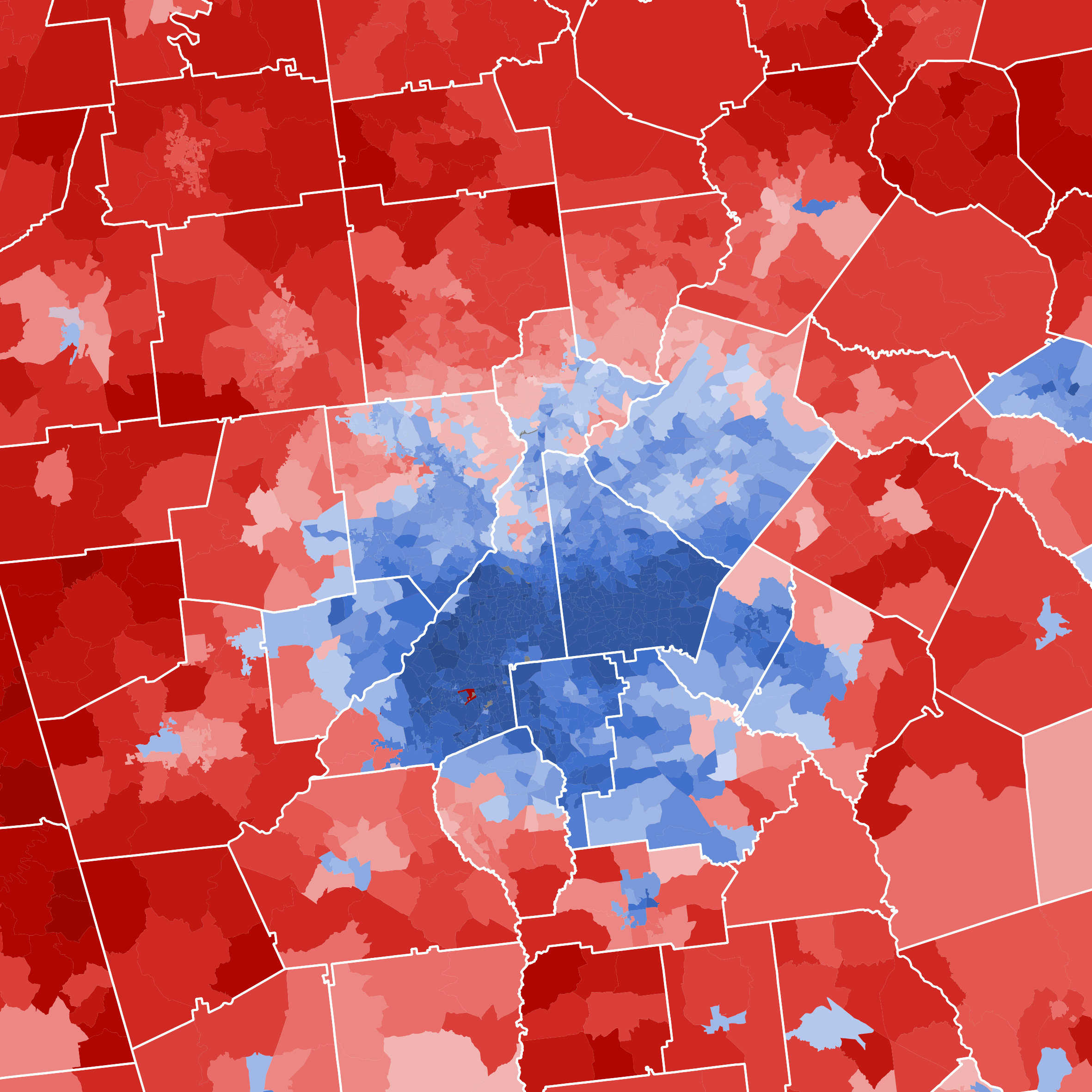
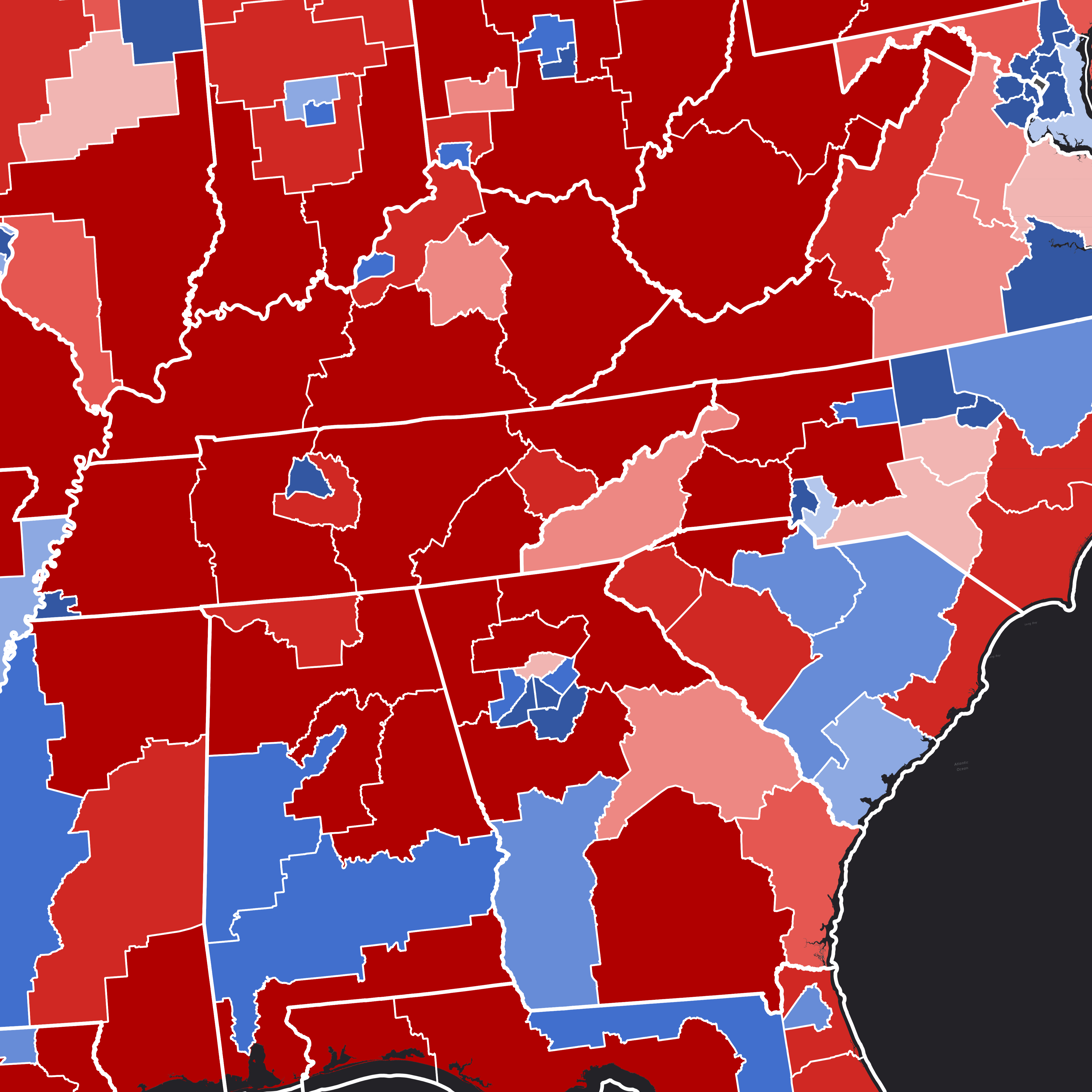
Working with the Times' election analytics team, I researched, created, organized, and contributed precinct shapefiles crosswalked to precinct-level election results for their interactive 'Extremely Detailed Map of the 2024 Election'.
View NYT Map
VoteHub
Election Cartographer
I spearhead VoteHub’s geospatial data collection efforts and maintain the underlying datasets that power the site’s election maps. I also assist with backend data infrastructure and preparation behind VoteHub’s detailed live election night reporting (ENR) maps. Previously, I oversaw a project that created the first maximally complete interactive map of the 2024 election by precinct.
Visit VoteHub
StateNavigate
Political & Data Science Committee
StateNavigate focuses on state legislative forecasting and analysis. On the committee, I contribute to StateNavigate's data collection, tabulation, and verification. The team is currently preparing for deeper forecasting and analysis for the 2026 election cycle.
Visit StateNavigatePersonal Projects
2024 National Precinct Map
Working independently, I assembled and published a comprehensive national dataset of precinct boundaries and election returns from the 2024 cycle.
Redistricting Project
I created a set of redistricting proposals for all 50 states focusing on proportionality, communities of interest, compactness, and minority representation.
Technical Skills
 Python
 ArcGIS
 Excel
Excel MySQL
MySQL QGIS
QGIS Numpy
Numpy Pandas
 GeoPandas
 Matplotlib
 Seaborn
 Shapely
 Folium